Sunday, September 9, 2012

RIDGWAY ON A BIKE

Having moved from Alaska to Colorado, I had dreamed of longer and more frequent bike rides.  The tiny town of Ridgway, where my new home sits, is an old ranching and mining community of about 800 people.  The town has changed considerably in the past few years, becoming a Mecca for mountain climbers, skiers, fishermen: my kind of folks.  The old mining town of Ouray sits nine miles to the south in the narrowing canyons; Durango is about a hundred miles up the “Million Dollar Highway” and over three 11,000’ passes.  Challenging roads with no shoulders provide training rides for bike riders a third my age.  Speaking of Challenges, the first leg of the USA Pro Cycling Challenge, 683 miles over 7 days, started in Durango and went to Telluride.
 
Nori recommended we ride mountain bikes from her house in Ridgway, down Ouray County Road (CR) 5, turn up CR 24 and see the countryside from the back roads.   Except for the main State Highway (SH) 550 going to Ouray, and SH 62, a two-laner heading to Telluride and points west, all the roads are dirt, and the traffic is light.  Outside of town, much of the land is grassy ranchland.  It’s a perfect setting for a leisurely bike ride. 
 
Heading down the main drag we passed the True Grit Cafe the first “True Grit” movie starring John Wayne, Kim Darby, and Glen Campbell was filmed right here in Ridgway.  Pictures of John Wayne pop up in the cafes and saloons around the county.  Then we turn the corner and pedal up the hill past the Colorado Boy brewery, the home of award winning beer and finest pizza anywhere. Across the street is the Billings Artworks of Ridgway where the Emmy Awards are individually handmade and plated.  Then up the street past “Kates”, the best breakfast in the county…maybe anywhere.  Every meal is great: Ricotta & Lemon pancakes, grits with white cheddar cheese, huevos rancheros….I’m drooling already.
 
After dropping north down CR 5, past a beautiful old white ranch house, we headed up the hills alongside the creek, and turned north onto CR 25.   
 
The red sandstone cliffs on the north side of the road end on the great mesa of Log Hill, dotted with stunning homes and a golf course. 
 
 As we rode uphill for the next two hours, we passed a variety of homes and country estates.  Green fields, old cottonwood trees, firs, and juniper lined the road.  
 
 After a few miles we passed a fascinating house:  it was built into the ground with large banks of windows facing the south.  “Whose place is that?” I asked Nori.  “Dennis Weaver’s house”, she replied.   He was Chester of Gunsmoke in the TV series and McCloud, the New York cowboy lawman.  Dennis Weaver was an early environmentalist and humanitarian. His name is famous in these parts and his wife and sons still live here. 
 
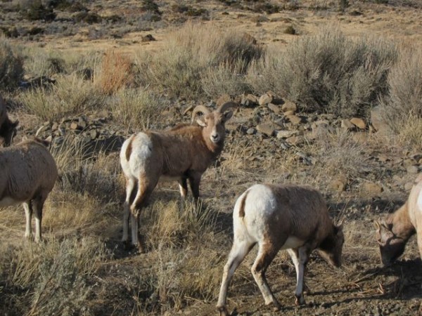
I rubbernecked at the scenery looking for birds and wildlife.  A few years ago a friend and I spotted a bobcat feeding on a deer carcass in a field below the bluff.  Today I’m seeing a lot of cattle.  Angus seems to have taken over the country.  When I was a kid I could see a variety of cattle in the fields: Holstein, Guernsey, Jersey, Hereford.  One ranch does have Texas Longhorns.  What’s with this mono-culture of today?  One species of wheat, corn, potatoes…  And, there are some strange creatures in the fields: a herd of about 30 yaks next to my new house.  My friend Peter has a Bactrian camel, a cow, two llamas, and a goat that all hang around together.
 
But I digress…  Up the road on the south side is Ralph Lauren’s ranch, the Double RL Ranch.  Its 16,000 acres stretches across the highway to the south.  You can see all about it with Oprah on the internet.  Apparently he still rides around in an old blue Jeep. 
 
We pedal uphill for miles.  It never seems to let up, however the grade is not too steep, just continuous.  I have a 
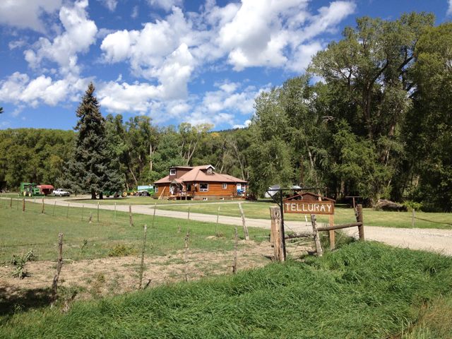
one-speed 29” bike, not too fast, but a ton of fun.  Now to the north is Charlie Ergen’s Telluray Ranch.  Charlie owns Dish network, if I remember correctly.  I think I have a “Dish” dish on the house I’m buying. 
 
 Anyway, it’s beautiful country.  The green grass is at its height, and several tractors and mowers are cutting the hay and bailing it for the winter. 
As we make uphill progress, Nori asks where all the cattle are then answers her own question:  Probably still in the high country she says.  Just then a caravan of cattle trucks heads down the road in our direction kicking up a cloud of dust.  We pull off to the side of the road to let them all pass by.  Hunting season has started, and no self-respecting rancher would leave his cattle in the high country while the entire state plus most of Texas is carrying rifles and trying to shoot a deer or an elk.  When I was a kid in Utah, there were billboards with a picture of a cow and a picture of a deer, both labeled so ‘Foreigners’ (Texans) would know the difference.
 
As CR 24 intersects with the highway, the sun is now high, sweat has soaked my cycling clothes, and our legs seem to know it is time to turn around.  We still have an hour to get home.  The view back is different but even more inspiring.   
 
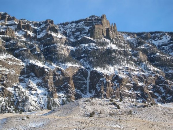
To the south the 14,150’ Mount Sneffles and the San Juan mountains line up along the horizon.  To the east, the direction we are now heading, the Cimmaron range with Chimney Peak and the Citadel cover the skyline.  I stop often for pictures, but wonder why.  This is now my home, and I don’t need to capture it all in a camera.  I can come back tomorrow.

Monday, July 9, 2012

Descent Into The Black Canyon

Saturday, my friend Nori and I drove out of the rain in Ouray and Ridgway heading for sunnier climes: The Black Canyon of the Gunnison river, just east of Montrose, Colorado, appeared to be warm and sunny.  It was a fine goal.  I flashed my Golden Age Passport at the park entrance station (I always hated the name Golden Age; who thinks up these things???)  Nori asked Maureen at the information desk to suggest a hike.  The normal trails seemed to ramble through the scrub oak.  We wanted to descend into the canyon.  This involved getting a "Wilderness Permit" just to scramble to the bottom.  Hmmmm!  Maureen described the descent in excruciating detail and made us sign the permit that we would be our own rescue team, wouldn't steal from the park, etc.  Then we headed down the route...not a trail, according to the Park.

 Nori peeks over the edge and starts down

It coursed for a few hundred yards through the scrub oak, then dropped precipitously through the Douglas fir trees into an 1,800-foot scree and boulder pile straight to the Gunnison River.  As we scrambled, signs warned us to go no further without the required permit.  Hmmm!  We had the permit.
 The Black Canyon opens in full splendor

My daughter Daphne had given me a Sony Bloggie camera for father's day.  I became a nuisance to Nori stopping often to capture a scene.  To a rock and mountain climber, this is heaven. Huge rock walls composed of pre-Cambrian gneiss and schist.  Threading through the rock were enormous seams of lighter pegmatite containing giant crystals of quartz, feldspar, and mica snaking through the darker bedrock.  As we hiked, we spotted large chunks of white quarts lying among the dark schist.  
 We spy the river below

Nori was having a blast, being careful and admiring the National Park's scenic wonders.  She made the obligatory complaints that this was hard and scary, but continued down undaunted.  About a third of the way down the "trail" drops precipitously for about a hundred feet, and the park service has graciously affixed a logging chain to a tree for a handhold.  I wished they had spent their effort making a short switchback here to prevent the erosion and increase the safety.  Down we slithered.
 The dreaded chain down the nearly vertical dirt and rocks

Looking across at the cliffs on the other side we gauged our progress in thirds.  It was a furnace with little cloud cover, so we stopped at each third and drank from our water bottles.   The Black Canyon is a popular venue for rock climbers, but the routes are extremely difficult, so only the very skilled climbers venture down to the bottom.  It is the opposite of mountain climbing where a climber ascends the mountain, then descends on a rope.  Here the climbers descend gullies and rappel on the ropes, then climb out to the canyon rim.
 Half way down, we look across at the sheer rock walls

The dirt and bushes turned to scree hanging on the angle of repose.  We carefully placed out feet on the larger rocks to avoid dislodging them and sending a rockslide down the gully onto others.  These rocks are old, metamorphic rock, created in a molten state about 1.7 billion years ago making them some of the oldest rock in the country.   About 70 to 40 million years ago, the entire area was part of the Laramide uplift.  Somewhere around 26 million years ago huge volcanoes drenched the landscape in deep lava.  
 The route angle lessens near the bottom

Then, as recently as 2 to 3 million years ago, the region uplifted again, and the west-flowing Gunnison river quickly cut a channel down to the old bedrock.  Currently it is eroding down at a rate of  one inch per hundred years.  Extremely quickly in geologic time.  It is the 5th steepest river in North America, with an average drop of 34 feet per mile.  We could see the rapids everywhere.
 Nori descending

Once at the river, the scenery changed: willows, alders, a few pines, grass, and poison ivy abound.  
Maureen in the Visitor Center had warned us not to drink the water or swim in in: too cold!  Hmmmmmm!  It looked fine to me.  The only reason I didn't jump is was because two fishermen were trying to catch the wily trout.  Being from Alaska this looked and felt like the tropics.
 The Gunnison River

We took a tour downstream and talked to a young couple who were working in North Park (north of the famous South Park!) at a National Wildlife Refuge.  Everyone we met was happy...almost.  I think a girlfriend talked her boyfriend into it, and he was no so gleeful.
 The happy camper at the bottom

We found shade under a tamarisk and ate some nuts and raisins, gulped more water, and prepared for the climb out.  We were surrounded by high canyon walls, and the only exit was the way we had descended.  We bet it was faster and easier to climb up frontwards than to climb down facing out.  Hmmmm!
 Looking up about 2,000 feet to the north 

It was quite a feast for the eyes.  A few vultures flew ominously overhead.  I scouted out climbing routes and thought about bringing a fishing rod next time.  Although I didn't see anyone actually catch a fish, I know there are big brown trout in the river.
 Elegant towers loom over us

The climb out was easier, but tiring.  We looked up and saw huge storm clouds, the ones that were raining on me in Ouray in the morning when we left.  Up past the scree, up through the steep ravines, past the chain, and finally onto the final stretch to the visitor center to turn in our permit, proving that we had not been swallowed by the chasm.  
The lunch spot on a log at the river

One more hike off the bucket list!  It had been a fine day, and we had 'cheated death once more'.  

Sunday, February 26, 2012

Southfork Ice Festival


A view of the cliffs lining the Southfork of the Shoshone River.  Grea...
A view of the cliffs lining the Southfork of the Shoshone River. Great ice: one of several hundred such climbs.
Credit: AKTrad
[Edit this Photo]


Don Foote had called and asked me to present a slide show Saturday night at the ice festival in Cody, Wyoming. Having never climbed there, I accepted immediately. Don drove me up the Southfork road accompanied by a continuous narration of the climbs as we passed them; he was a mine of information as I craned my neck to see above. The road was littered with deer, thousands of them, then sheep, then elk. I even spotted a cat hunting in a field.


Bighorn sheep on the road.
Credit: AKTrad
[Edit this Photo]


The next day, we met "The Germans", Marco, Klaus, Christian, and Carmen. Marco had come a year before at the invite of his friend Werner, a Cody local. Now I had partners and relied on their experience to lead me to a fine new climb. They inadvertently led us to a detached hollow slushpile. However we had a blast in the warm sun. I let up the mush while they tried to call me down. At the top I grabbed a 2" willow that broke off in my hand, but I belayed from the scrub anyway, depending on the experience of a lifetime of rotten belays. It seemed normal.


The slush blob appears
Credit: AKTrad
[Edit this Photo]


Marco on belay...for all the good it would do!
Credit: AKTrad
[Edit this Photo]


Klaus shades his eyes from the melting sun
Credit: AKTrad
[Edit this Photo]


Christian gives our effort a thumbs-up.
Credit: AKTrad
[Edit this Photo]


The Germans had been climbing for several days straight, so this was a great rest day for them. I hadn't climbed ice in a month, except for chopping the ice off the eves of my house after the continuous snowfall of the past several months in Anchorage. The mushy ice caved under my feet. A sheet of water ran behind the ice-like substance I was standing on, and a hollow "Thunk" shuddered the whole edifice at every blow.


Klaus with a resigned look, ready to go!
Credit: AKTrad
[Edit this Photo]


Werner emerges...
Werner emerges...
Credit: AKTrad
[Edit this Photo]


Carol and Jen arrived from Boulder, lifting my spirits even higher. I had discovered the Silver Dollar bar and grill the night before, so we all headed over for beer and burgers.


Kate, my new best friend at the bar
Credit: AKTrad
[Edit this Photo]


The menu of 3 items!
Credit: AKTrad
[Edit this Photo]


I asked Kate, the server, what I should eat. "A Hamburger!" she replied. I looked at the menu. Only three items, the first was the burger. I saw they had IPA on tap. I was in heaven.


Waiting for Godot...and a hamburger with my IPA.
Credit: AKTrad
[Edit this Photo]


Paradise on earth
Paradise on earth
Credit: AKTrad
[Edit this Photo]


The rest of Team Germany had taken a rest day, but there was no rest for Marco when he heard Carol and Jen would be along. We picked "Chasing the Sun" at the end of the road and a short 45 minute hike up the boulders. It turned out to be an excellent choice. It was Jen's first ice climb. She is a fantastic ice climber and had just started her new job as the Rocky Mtn Regional Rep for the American Alpine Club.


Jen and Carol approach "Chasing the Sun"
Credit: AKTrad
[Edit this Photo]


A big smile seeing the ice!
Credit: AKTrad
[Edit this Photo]


The vertical curtain of ice was bullet hard in the morning sun; it would be a perfect place to learn.


The first pitch
The first pitch
Credit: AKTrad
[Edit this Photo]


Carol led up the left hand edge with Marco. I took the right side and set up a top rope. Jen floated up the ice. I was impressed.


Jen flying upward
Jen flying upward
Credit: AKTrad
[Edit this Photo]


Don had volunteered us to teach a clinic for beginning climbers on Saturday. Nineteen folks were supposed to be in the clinic with five instructors; twenty six showed up. It was excellent! To weed out the weak, the snow-covered road stopped several of the huge trucks and became stuck on the hill. Like wounded hippos, We abandoned the wounded ones like hippos on a riverbank, filled the rest with the crew and continued on. The greatest casualty was the Doc, who slipped on the road and snapped his humerus off at the ball. Don took him back to the hospital.


Allie & beer!
Allie & beer!
Credit: AKTrad
[Edit this Photo]


The three large climbs of grade 2 and grade 3 ice were an hour's drive and a 45 minute hike, guaranteeing that everyone who made it would be in moderate shape and warmed up. The guides set up 4 top-ropes, and we went to work with the crowd, giving everyone a chance to climb all four. It was a Wyoming Bubba event, so a huge smoky bonfire was soon glowing, warming the cold souls who roasted hot dogs.


Climbers practice on the line of ice, while bystanders cook hot dogs.
Credit: AKTrad
[Edit this Photo]


Shane with battle wound
Credit: AKTrad
[Edit this Photo]


Don arrives after medical duty on the Doc
Credit: AKTrad
[Edit this Photo]


By 3 pm we were done, and I had a slide show to present at 8. I'm sure I had the most fun, recollecting the 1967 rescue on the North Face of the Grand Teton and the lives of my friends who lived through it with me. Looking into the audience, I saw old friends like George Lowe, John Bragg, Mary Ann Dornfeld. And new ones like my nephew's wife's brother Pete McConkie. I had a great evening slurping down the free Ranger IPA, compliments of New Belgium Brewing.


The SAR folks ascend the choss and scree
Credit: AKTrad
[Edit this Photo]


But Sunday morning came early. Don had roped me into helping him teach a clinic on mountain rescue to the local SAR groups. We headed out in Don's huge Suburban loaded with the coolest rescue gear ever. I, who come from the era of goldline ropes, steel carabiners, Stokes litters, and bowline knots, would be helping instruct a state-of-the-art rescue school. Well, I could help them be safe. And, I'm not a total Luddite; I do use new gear!


On the slick traverse to the climb
Credit: AKTrad
[Edit this Photo]


We scraped up a scree pile, across a somewhat dangerous traverse and down to the top of a nice 60 foot climb where Don set up a very modern tripod and pulley.


Working with the rescue tripod
Credit: AKTrad
[Edit this Photo]


I'm sure I learned the most. It was a great group of folks from the surrounding communities. Everyone had a turn both lowering and raising the litter using the traditional 3 to 1 pulley system over the tripod.


The folks haul on the 3:1 system
Credit: AKTrad
[Edit this Photo]


Very cool! I'll be back next year for sure, and I'll plan to spend more time searching out those big drips.