Friday, December 10, 2010

CHARLOTTE ON ICE

Charlotte called: “Want to go climb ice tomorrow?” We talked for a while about friends, climbing, and plans. It had been a great summer of climbing, biking, hiking, friends, family, but here I was in Ouray now contemplating climbing on ice. Living in Alaska I climb more ice than anything else, but climbing with Charlotte is always a treat, so I was psyched to go. She arrived on the minute, picked me up, and headed up the Camp Bird road where we met her good friend, Chris.

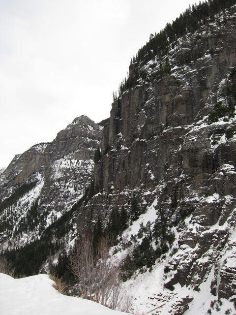
Camp Bird Road - ice climbs abound


I rubbernecked the entire ride, eyeing ‘The Ribbon’, ‘The Talisman’, ‘Birdbrain’ and other climbs on the north side of the creek. Arriving at the parking lot we knew we’d have most of the climbs to ourselves; a 10 am alpine start in Ouray guarantees solitude. As we hiked up the road, your sea-level guide was gasping like a guppy in bad water; we were near 9,000’, and I, a member of AARP, was wearing boots and carrying an alpine pack. Two of the Skylight climbs were fat. We stopped at the first one, ‘Slip Slidin Away’. Chris made his apologies and departed to mend his incipient bronchitis. Charlotte was left with me.

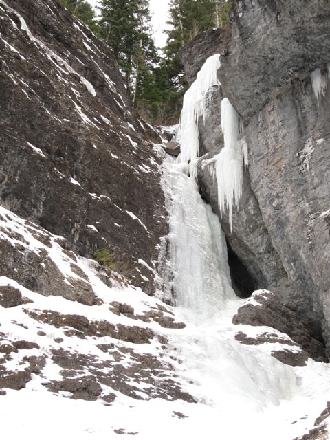
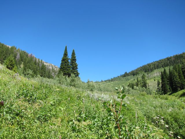
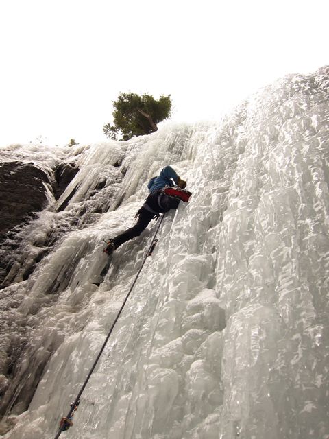
Our Goal - “Slip Slidin’ Away’”


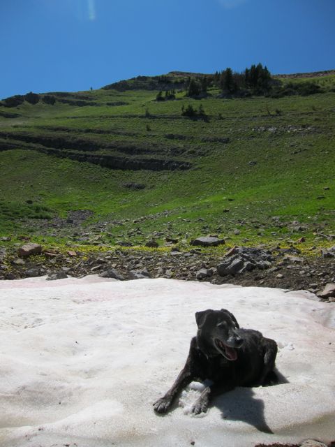
Dropping the pack, I felt relieved and a burst of energy impelled me to volunteer for the first lead. Charlotte’s dog, “Max”, was certainly full of enthusiasm for the fabric toy and never tires of fetching it. I think this is why Charlotte takes friends climbing.

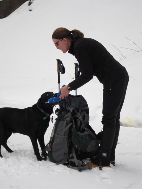
Giving Instructions to Max


The approach gully was warm, temperature of 42 degrees F. Snow balled up in my crampons in spite of a fine antibot plate. It would be truly embarrassing to slip down this pile of rocks and ice. I felt good to be in the mountains and on ice again.

The Approach is Sketchy


After saddling myself with too much gear for a first lead of the season I headed up. The first ice was plastic, and I cruised. What looked like a nice vertical curtain from the bottom, at the top was actually a sheet about a foot from from touching town, hollow at the back. I placed tools, was careful, but still couldn’t get good feet. After laying a finger aside of my nose...

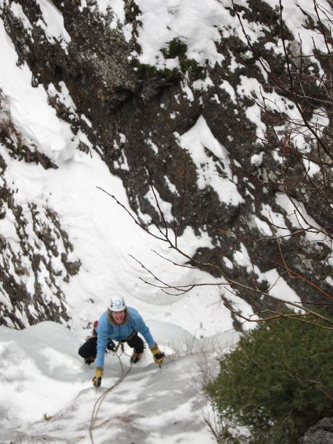
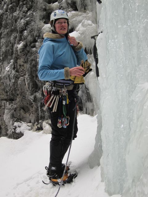
Cheerful at the start!


Charlotte cruised up; we rappelled the pitch, and coiled Chris’ twin and now soaked ropes.

En Rappel


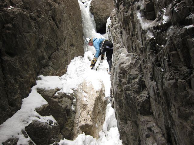
The next climb, ‘Chockstone Chimneys’ was another hundred yards up the road. Charlotte’s turn to take the sharp end. I slithered under the first chockstone, remembering Aaron Ralston. Canyoneering a couple of months ago, my friend Bob called wiggly chockstones “Ralstones”. I hoped none of these monsters fitted the category. The approach looked simple, so I put the hunk of rope over my shoulder and started up, finding a chimney, and two ice pitches on the way. I felt like the young girls who carried balanced water jugs on their head in Egypt many years ago. I had fine posture

All Roped Up and Ready to Lead


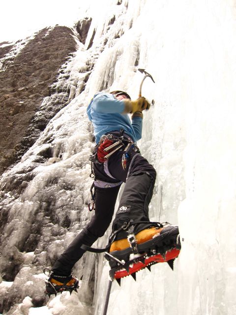
Charlotte was chomping at the bit. And up she went, no problem. I tried to take photos with one hand when she put in an ice screw. It’s an art. As Donini said, “I always have you on a tight belay...unless I’m taking your picture.”

“Chockstone Chimneys”


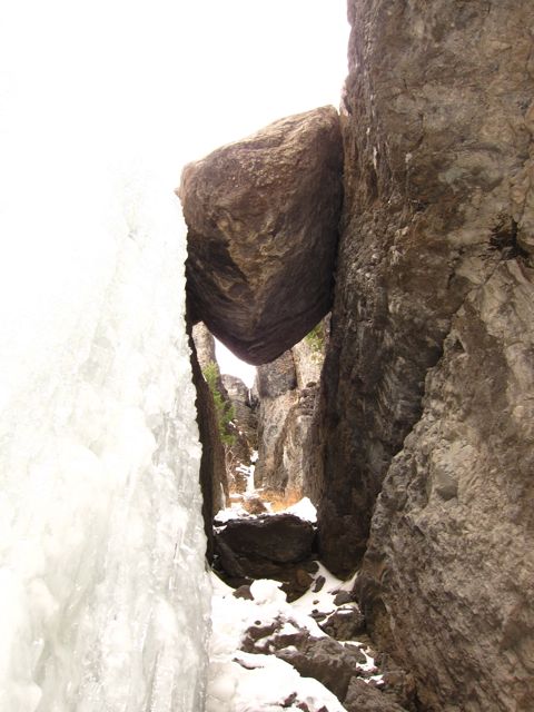
It’s an awesome spot. I peeked under the giant chockstone trying to formulate a good photo in my mind. After the climb I took a few, but it felt almost impossible to do justice to the scene. When I have a free afternoon, I’d like to hike up the cracks in these walls and explore; it’s that kind of place.

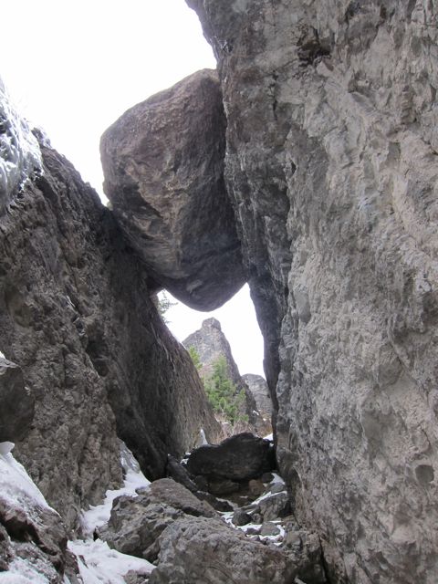
The Giant Chockstone


Placing the First Screw


Charlotte was fast, and careful, placing screws a good intervals, but moving up gracefully. The climbing looked fun as she cheerfully called down to me how great the ice was, how plastic, how solid. Some folks tire of ice-climbing’s repetitive movements, but somehow I never have. It seemed Charlotte hadn’t either.

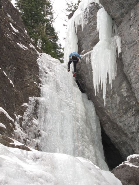
Charlotte Nears the Top of the Pitch


We ‘Yo-yo’d’ the pitch a few times, then headed down for lunch at the brew pub. This was a short day, to break me into the season, not trash me. I could have climbed all afternoon, but now I was cruising. I looked across at ‘The Ribbon’ again thinking I should climb it this weekend. Charlotte hugged Max. We found his toy. It was a great day.

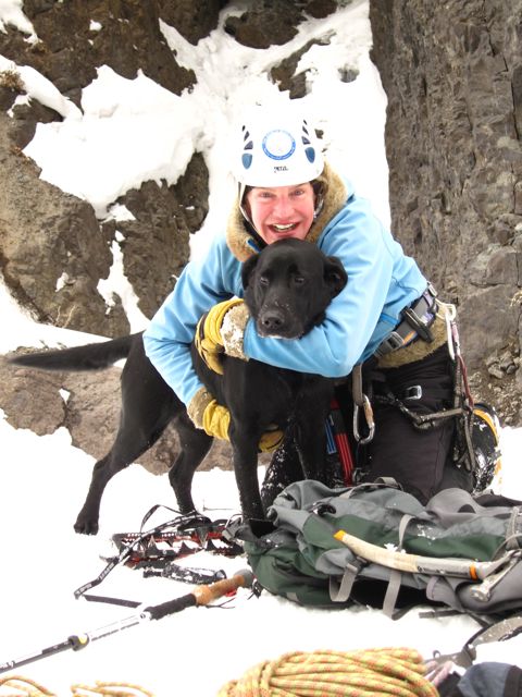
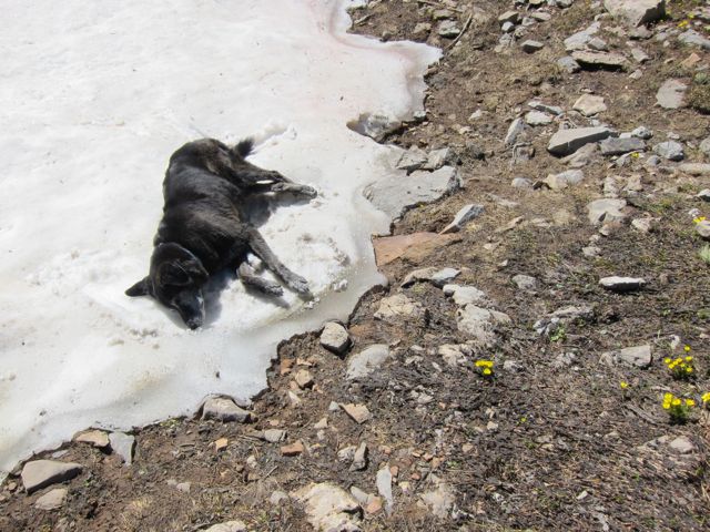
The Joyful Reunion with Max

Tuesday, August 31, 2010

Geezers on Albright Peak

We needed a few hundred thousand dollars...to finish the little film we started a year ago in Jackson Hole, Wyoming. Jenny had arranged for a fund-raiser at a friend's home, and we had agreed to meet and help her raise the money.

I had driven down the Alaska Highway in a large moving van two weeks before. My son Thor had offered me a car to drive the short 806 miles from Portland to attend the event. The Tetons seemed so close, so I hopped in the car and blasted cross-country, being somewhat amazed that the distance seemed quite a bit further than I had remembered it two years ago.

Ted had proposed a short hike up Death Canyon, an ominous choice for "The Geezers", and possibly a climb to the top of Static Peak. But at 7:00 am. We rebelled. At our age, 8:00 am mirrored reality a bit closer. My niece, Liz, called to say she had seen my Facebook note that I was in Jackson Hole; she would join us. When I reached the parking lot, Irene and Dan were waiting, packs on the back. Irene is one of the great climbers from my youth, having put up the most beautiful climb in the Tetons in 1957: "Irene's Arete." She is still full of energy! One by one the entourage trickled in: Rick in a Honda Odyssey; Ted, Holly, and Jenny in the Prius. I could hear the engine and the screeching of tires on the gravel; Liz driving the truck slid in with Allen and Ammon.

Irene and Dan, nattily attired, led off up the trail. She knew exactly where to turn off the main trail up Stewart Draw and the old horse trail that would lead us directly to the Static Divide. Soon the trail disappeared, but Irene and Dan held forth. I, coming from sea level, was panting like a chicken that is too hot. There was no trail, but Irene navigated from bush to rock, over the creek, and seemed to know every step of the way.

Irene leads Rick and Dan through the vertical bushes

The day warmed and the sun beat on my neck. I had presciently worn shorts and a short-sleeved shirt, an entirely different uniform than I would have been seen in in the '60's, due to climate change. It is no more apparent than in the high mountains and the arctic, the two areas I've inhabited all my adult life.

Upward through the rocks on a bear trail

Voila! Static Peak popped up over the western horizon. The final push to the divide led through a beautiful meadow filled with daisies, lupine, and wild geraniums. I had promised Liz that I was only going on a 4-hour hike, so she could confidently tell Allen to pick her up a few hours later. I had lied. It was now noon, and the group was divided about going up Albright Peak to the east, or Static Peak to the west. We had lunch at the saddle, took a hundred photos, dithered and talked.

Dan, Irene, Rick, Ralph, Holly, Ted, Jenny

Irene and Dan headed for Static Peak; the rest of us went up Albright, a new summit for all but 'Yours Truly'. The cliff face to the north was awesome, and the route ran right along the edge. A slip would have dire consequences, so everyone watched their footing as I coached and cajoled the crowd. The summit was beautiful, vistas in every direction: Yellowstone to the north, Jackson Hole below to the east, Driggs, Idaho, to the west. The Grand Teton loomed behind the group. But, just a month before, 17 people had been caught in a lightning storm on the Grand, and an all-day rescue effort by the park service had made national headlines. A huge thunderhead seemed to appear almost suddenly overhead. We skedaddled down the ridge.

The summit:
Rick, Ammon, Ralph
Jenny, Holly, Ted, Liz

At the summit we discussed the merits of descending directly down the "trail" we had ascended, or going the long 8-mile trail down the west side of the Static Divide into Death Canyon. What the hell; go the scenic route down into the canyon. I was so far beyond the 4-hour mark I had Liz call her friend and apologize. Down, down, down. What had taken a few hours to ascend now turned into another 4-hour march, albeit through incredible country. Switchback after switchback down a trail built into the steep mountainside 1920, still beautiful, still strong.

Liz & Ammon on the Static Divide trail: seven miles to go!

We finally arrived at the parking lot about 3:30 in the afternoon. We reunited at 'Dornan's' in Moose for the chuckwagon dinner. No one else showed up for a long time, so I had dinner with Dick and Barb Barker, listened to the Hootenanny, and waited for "The Geezers". Beer on tap was excellent; I had a pint of my favorite, the IPA. And, as is only right, we seniors closed the bar!

Monday, August 23, 2010

In the Tetons with Wister


He’s not Owen Wister, author of “The Virginian”, but a fine dog. And not even my dog; I’m just his buddy. He is Amy’s darling.

Each year I have visited Jackson Hole to climb mountains, hike, and visit old friends. My friends Forrest and Amy have been my hosts at their home in Teton Village. Whenever I show up Wister is my hiking companion. The old hound is fourteen years old, graying at the muzzle, part Black Lab, Greyhound, and Border Collie. Wister even has his own Facebook page: ‘Wister the uber-mountain-mutt’. Photos show Wister atop dozens of Wyoming peaks, including over 50 peaks in the Wind River Range of Wyoming, including six ascents of Gannett Peak, the highest mountain in Wyoming.

Our favorite jaunt is Mount Taylor: drive over Teton Pass, down the west side to the Coal Creek parking lot and hike up the Wilderness trail. So, when Forrest and Amy felt their 3-day 3-peak marathon tour of the Wind Rivers last weekend might be too much for the old guy, Wister and I hopped into the Subaru and headed for Teton Pass. But first an unannounced visit to Dick, my fine friend in Wilson, Wyoming. Dick and I started climbing mountains together, and his father, Rich, was our mentor. Fortunately my surprise visit prevented him from cleaning the house or mowing the lawn. We walked up to his deck and started in on the coffee; Wister made friends with the three other big dogs in the yard. After a short while our friend B.J. drove in and joined the coffee klatch. We hadn’t seen each other in years and reminisced about a kayaking trip we took in the old Ford Econoline 35 years ago when the dogs rolled in something terribly dead outside of Las Vegas. Soon Peter and Diana arrived; Dick now had no chance of working. After serious discussion and plans for dinner, I left the group and headed over Teton Pass.

Ralph, Peter, B.J., and Dick with cell phones

The Senior Geezers in Wilson, WY


The trail up Coal Creek towards Mount Taylor passes into the Jedediah Smith Wilderness area steeply up through Douglas fir, lodgepole pines, and blue spruce, cutting across meadows of wildflowers and bushes in full bloom.

Coal Creek


About 2 1/2 miles up, the trail crosses the Coal Creek, and since Wister has done this hike a number of times, at least three with me, he knows it’s time to cool off and rehydrate.

Wister in the brook. Time to cool off!


The meadow is expansive and covered in sticky geraniums, daisies, arnica, and other flowers. Hundreds of tiny blue butterflies fluttered above the mud of the stream.

The brilliant blue butterflies next to the water


Wister cooled his belly, lapped up the water and regrouped for the final push to the summit.

Wister gets a drink


The trail goes up at an aggressive angle, and the heat cooked us quickly. I started to sweat and Wister panted. Half-way up, Wister found a snowbank in the old rock glacier where a chunk if ice had formerly melted out leaving a huge depression that fills with winter snow and doesn’t melt till fall, if ever.

Wister finds snow


He looked at me, waiting till I stopped, then he splayed out on the snow to cool off his under belly. I’m sure he had done this hundreds of times, and he wanted to know that I knew that this stop was the protocol.

And wants to nap in the heat of the day


When I sat down to take a drink, Wister took it as an indication that he could take a short nap on the cool bed. I hated to wake him...

Asters


So, I took the camera and walked a few feet to take photos of the brilliant display of wildflowers in bloom. It had been a cool summer with lots of precipitation, and the blossoms were at their peak, even at 10,000 feet.

Wild Geraniums


Geraniums, columbines, whole meadows of buttercups, lupine, asters, arnica, daisies, yarrow, Indian paintbrush (both brilliant red and yellow varieties).

Onward and upward through the flowers and boulders.


Even though it was the heat of the day, we were of a mindset, “the summit or die!”

Entire meadows were in full bloom.


The trail wandered through the glacial cirques, then switchbacked up the hillside through spruce and pine trees. Near the top we stopped in the shade of an ancient whitebark pine, likely 500 years old, twisted by the wind, cold, and sun. Wister loved the shade and plopped down in the cool flowers and bushes while I grabbed a drink of water from the bottle in my pack. I tried to dribble some on my companion’s tongue, but he seemed not to care.

Wister nestles into the bushes under a tree to escape the heat...I follow.


The whitebark pines have been under attack by a pine-bark beetle for many years now, and some of these giants on the ridgetops likely are over 1,000 years old. Now they are dead or dying. The Park Service and Forest Service have attached little pouches to some to the trees to attract the beetles so they will not bore a hole and lay the eggs which turn into the larvae that girdle the tree bark and kill the whole tree.

Dead Whitebark Pine trees, killed by the pine bark beetle.


Up, up, up to the summit! We reached the final ridge where only a half mile and a few hundred feet separated us from the summit. I looked down through the bands of sandstone, grass, limestone, and other strata. These old sedimentary layers cap the mighty granite pluton of the Teton granite underneath. Taylor Mountain is the furthest south peak in the Teton Range.

Looking at the summit; the banded sedimentary layers below.


Even along the summit ridge the wildflowers were superb: gentians, sky pilots, arnica, buttercups, lupine, geraniums...

The blue ‘Explorers Gentian’ sits between sandstone slabs on the summit.


Wister knew the summit, lay down and enjoyed the moment. I scanned the horizon in every direction. The Grand, Middle, and South Tetons, Buck Mountain, and Mount Wister loomed to the north.

Wister makes the summit for the umteenth time. The Grand Teton twenty five miles in the background.


Pierre’s Hole to the West. Jackson Hole to the East. A huge jet airport reminded me that this was not the wilderness of 100 years ago. Even the wilderness of my youth. Now multi-million dollar homes filled every grove and overlook the river banks, filling former hay pastures and fields.

The view of Teton Valley from the top


After a brief stay on the summit we were both ready to find some water. Wister knew the routine and headed down leading the way. He seemed to feel I knew what I was doing and let me set the pace. Once more into the drink, cooling off the belly and loading up on the stream water for the final descent. Now, off to dinner at Dick’s. I hope he got that place cleaned up!

Good buddies!

Friday, August 20, 2010

Biking the Columbia Gorge

“Dad, you and Cathy should go bike from Hood River to The Dalles”, Thor said. I had driven down the Alaska Highway with Cathy in her ‘Jumbo JH’ U-Haul Moving van from Anchorage to Portland and was enjoying the warm sun and fine weather. I keep a vintage handmade Italian road bike made by Ciocc at Thor’s house, so I don’t need to transport it every time I head south. So Cathy and I drove to Hood River and headed east on old Highway 30 above the town towards Mosier. The old road is closed to all but foot and bike traffic and has been newly resurfaced, so it’s a dream on a road bike. The first section rises steeply, and the day was hot. Below us the Columbia river runs west to its mouth at the Pacific. I thought of Lewis and Clark in the region, over 200 years ago.

The Columbia River below

Cathy is in fine shape and pulled ahead. I’d been dormant for a month, and my thermostat has been set to ‘winter for the past 10 months, so I suffered mightily pulling the first couple of miles uphill in the hot sun. Cathy muttered something about ‘Mad dogs and Englishmen...’

Cathy


The old road sits high on the hillside. Constructed in the 1920’s, it is a marvel of engineering and landscape architecture, coming from an era when aesthetics and form meant as much as utility and function. The sidewalls and overlook terraces of the road were built by hand with local stone mortared into place. The road follows natural contours and weaves through the countryside; little scenic pullouts provide a view of the Columbia Gorge and surrounding landforms: The great Cascade volcanoes, Mount St. Helens and Mount Adams to the north, and Mount Hood to the south.

Yours Truly with the vintage Ciocc bike: sew-up tires, downtube shifters, pink paint job!


It is a popular venue with the local cyclists. Hood river has become a thriving artistic and resort community. Brewpubs and fine restaurants dot the street where Patagonia, bike stores, and sailboard shops predominate. Real estate is pricey. I asked Thor what all the seemingly idle young folks did for money. “Parents”, he answered.

The bike trail and overlook, a popular place


After five miles, the road is open to cars, but since it doesn’t go anyplace, few were seen until we coasted downhill to Mosier, a sleepy little burg with a couple of shops. We decided to push uphill another six miles to Rowena Crest where the overlook was said to be excellent. The wind was in our back and we made good time.

Looking upriver from the Rowena Crest


At the Crest we had another decision to make: turn around in the heat of the day and head for a cool lunch somewhere, or take the Tour de France-like hairpin turns down 2 1/2 miles to Rowena just to say we did it. The architect of the road built the grades to no more than 5% and the turning radius that would allow a semi-truck to negotiate them. We couldn’t resist. How would we face our kids if we didn’t do the Rowena Loops. Down we rocketed. I worried about a bulge in one tire, so I applied the brakes on the turns. Cathy did not! We exceeded the speed limit, usually difficult on a bike, but could not resist. At the bottom we simply turned around and started the long pedal back uphill. We almost did it a second time.

The Rowena Loops


Now we were heading back west into the wind. The hot air pounded hard into our faces and dried the sweat instantly, leaving a salt crust on our skin. We even pedaled downhill, otherwise the wind would stop the bike. At Mosier we stopped at the only shop: it sold ice cream and Porsche cars. I’m always interested in these little businesses that say things like, ‘Tanning Salon and Gun Store’. We needed water desperately, so we ordered a mocha milk shake, and although it tasted great, it sat like a bag of marbles in my stomach. A glass of water would have been better. The woman filled our bottles for the rest of the ride. I was intrigued by the Porsche shop filled with memorabilia from years gone by. What a cool place!

Ice Cream and Porsche store in Rowena


Only six miles to go till beer and pizza at the Double Mountain brewery in Hood River. They make the best pizza, and the IPA is killer! As we sat at the sidewalk table, the waitress made conversation and asked her if she were local. ‘Yes, I’ve been here four years’, probably an old timer by resort town standards. At the neighboring table a loud drunk talked about how Memphis was so great and how Oregon sucked. I almost suggested he return, but the pleasure of the day prevented any unpleasantness. It was so fine we will likely do it again!

Thursday, May 13, 2010

A HIKE ACROSS ALASKA or HOW I STAY YOUNG

My friend Forrest called this spring, "Ralph, how would you like to help me and Michael. We are flying in to meet Andrew Skurka who is hiking across Alaska, and we need a ride."

My friend Forrest and wife Amy live in Teton Village, Wyoming, and they are first-class folks. Amy tended the bar at Moose Entreprises for a dozen years, was Assistant Director at the Murie Center, worked in finance, and is now the director of the Teton Raptor Center. And I can't keep up ith her on a hike... Forrest is a bundle of energy, a former Exum mountain guide, Alpine Ascents guide, and now director of the Winter Wildlands Alliance. He always has a great project going. The two of them are some of my best friends ever. So, Forrest knew Andrew, who knew National Geographic, who hired Michael. Michael is a National Geographic photographer on assignment to photograph Andrew. And Forrest asked me to drive them to Talkeetna. That's how I got involved.


Forrest fuels up

Forrest arrived in town, and mi casa es su casa for both of us. I love having Forrest visit; he imparts a huge amount of energy and enthusiasm that gets me out and going. At the Bear Tooth Grille he regaled me with stories of his recent adventures and the work of the Alliance. The next day we met Michael at the Sheraton and loaded his ton of photographic gear in the trusty Subaru. Michael, originally from the Skagit Valley, Washington, has a masters degree from Ohio University in Visual Arts and a bag-full of cameras. He is spending a year in China living out of a van and documenting the changing way of life there. But National Geographic called and pulled him off his project for a few months to follow Andrew. You can check out Michael's exquisite photos at: http://www.mcbphotos.com/

We were off: picked up camera batteries and headed to Talkeetna, the hub for mountain climbers going up Mount McKinley. Paul, the owner of Talkeetna Air Taxi would fly them across the Alaska Range, drop them at a deserted airstrip in hopes that Andrew would arrive there after skiing about 500 miles south from Kotzebue, the Inupiat village above the Arctic Circle.


Michael downloads photos on the back of the Subaru

I had heard of Andrew many times and of his ultra-marathon hiking adventures. Among the 23,000 miles he has hiked in the past 8 years, his projects include a 6,875-mile Great Western Loop linking the Pacific Crest Trail from Canada to Mexico, then back up the Continental Divide trail back to Canada. And the 7,778-mile Sea-to-Sea route from Cape Gaspe, Quebec, to Cape Alava, Washington. National Geographic named him "Adventurer of the Year". Besides his hiking, he raced the "Leadville 100" for a lark and came in second. You can check out his bio and hikes at: http://www.andrewskurka.com/AK10/index.php


Andrew models his new duds

The two of them were all energy and enthusiasm, so after paying my respects to the wonderful women at Talkeetna Air Taxi, I headed home, my work done. A few days later I got a phone call from the Satellite Phone. Boot problems! They were flying back and need me to find new ski boots for both of them. Bummer!!! For a wild two days, we shopped every ski store and Thrift Shop and found only only one pair of boots for Michael. So, we bought a hunk of steel, and I set about making a new steel toe for Forrest's boots in my shop. They worked beautifully in the shop, but I worried about their trail-worthiness. Back to Talkeetna we went for Paul to deposit them at Wonder Lake to meet Andrew and go with him over Anderson Pass and the middle of the Alaska Range.

A week later the phone rang: they were in Cantwell, 210 miles north, and needed a pick-up. I hopped in the mighty Subaru and headed out, finding them with Andrew at the post office, opening packages full of food, shelter, and clothing for the next leg of the trip. I offered fresh bananas and a dozen donuts, welcome food after the freeze-dried meals they had been eating.


The Crew lounging in front of the Cantwell Post Office

Snow patches lingered in the shade, but the valley bottom was mostly snow-free, so Andrew changed into his new gear: thin nylon pants, shirt, and running shoes. He repacked all the gear his parents had sent to the Cantwell PO, organized all the food into a waterproof bag, stuffed the new sleeping bag and stove. He checked his itinerary, neatly printed out in the map folder; he has scheduled the entire year-long trip by the day into 30-mile segments. Then he sat down with his new cell phone and called home, reassuring his folks that he was on schedule and doing well. We headed to Tsesyu cafe, talked with the new owner who cooked great Mexican cuisine in the tiny village of about 100 folks. The hikers wolfed down the chow and wanted more!
Andrew unpacks his mail & regroups for the next leg

Andrew started walking north. Forrest, Michael, and I hopped into the Subaru and headed south, Michael to Talkeetna for aerial photos, Forrest and I to Anchorage. Now the energy of the group was split, but continued at high speed like a split atom. The next day Forrest suggested we grab Brad and climb up to the top of Hatcher Pass. The day was sunny and warm, so we climbed a peak and skied the creamy spring corn snow back to the car. The whole way Forrest talked with Brad about the current management plan for the area, irrepressible in his enthusiasm and ideas. When we got home, Forrest began planning a float trip down the wild Six-Mile Creek for the next day with Roman. I needed a day of rest!

Seward Pub Crawl

The day looked grim, just like the day before. Cold, dank, miserable. But I have a little house, and the four of us were stuffed inside with a huge pile of mountain climbing gear piled several feet high covering the living room floor. We had to get out. Looking south, the clouds seemed to be lifting, so I asked the guys if they would like to go to Seward, the tiny sea port 130 miles SE of Anchorage.

A quick detour up to Flattop to check out the panorama of the Alaska Range: Denali and Foraker in the north; and the start of the Ring of Fire down the Alaska Peninsula: the giant volcanoes Mt. Spurr, Redoubt, and Iliamna in the west. Still a lot of snow!

Chad One phones Gina; Mike is all grins

My guests were two disabled veterans and an out-of-work photojournalist, in Anchorage for a few days before flying into the Ruth Glacier to climb the dreaded Moose's Tooth, a massive granite monolith in the foreground of Mount McKinley. Chad One had lost his leg after an IED explosion in Iraq; Chad Two, had lost his leg in a car accident. Mike was a bundle of energy photographing everything his eyes landed on.

Ralph, Chad One, Chad Two, Mike
Girdwood, Alaska

The drive south along Turnagain Arm is one of the most awe-inspiring journeys in Alaska. The massive tide was emptying the basin, so the crew wanted to stop and watch it flow past. Above us thirty Dall sheep sat lazily on the mountainside in the sun. Six eyes rubber-necked on the endless mountains as I kept my eyes on the road and rocketed south in the little Subaru. We stopped for lunch in Girdwood, where our Russian waiter, an amateur photographer, bonded instantly with Mike who had him take a photo of us with his huge Nikon professional camera.

Seward, a little jewel at the head of Resurrection Bay. Steep cliffs line the bay as far as the eye can see. Nary a tourist in sight. A stiff cool breeze blew across the water, but we drove to the end of the road, hopped out of the car and the crew boulder-hopped down to the water's edge while the gulls screeched and swarmed overhead, trying to steal a loon's catch.

A brew sounded good, so we walked the street and found the Seward Alehouse where, joy of joys, they had Moose's Tooth IPA on tap. The bartender's thick Welsh brogue got us talking, and soon we were a close happy bunch.

Mike, Chad & Chad with the Welshman

However they didn't serve dinner, so we wandered out and checked the menus of the restaurants on the block. Holy Shit!! They were all way overpriced; I couldn't believe someone could charge $28 for halibut fish and chips. I had often eaten at Christo's Palace, also overpriced, but likely the best pizza in town, so I took the group there.

Christo's Palace, Seward, Alaska

Walking in from the dead cold spring to the warmth of At the back of the restaurant, a full-width bar built in 1890's and brought up from San Francisco in the 1980's covers the back of the restaurant. Made of mahogany and cherry, it was originally painted with black lacquer.
Unfortunately, or fortunately, the restaurant was destroyed by fire ten years ago, but the bar was saved. It now sits restored with new mirrors and original wood finish. Complementing the scene was Amber, a local woman with the perfect personality for our embarrassing quartet.

Amber at the bar

I noticed the wine bottles in the rack were covered in dust. Either it is only for looks, or no one in Seward drinks wine, just beer and whiskey. Likely the latter.


The cherry lion's head keystone in the bar

Carved wooden salmon adorn the south wall


Chad, Chad, and Mike enjoying a brew

I was the designated driver and took the time to take a number of photos. No tourists at this time of year, and business was slow, so we got to know Amber, the joy of the evening.

Mike is in love; Amber is a good sport!

The clam chowder, calamari, and shrimp covered Ceasar salad were excellent and within budget for the mountain climbers. We wandered onto the street in desperate need of exercise. Mike raced around town photographing Chad Two along the beach, in the street, by storefronts...

Mikes snaps Chad snapping Resurrection Bay

Seward is the start of the Iditarod Trail, where the serum run of 1924 began. A dogsled marks the spot on the south beach. Mountains rise in the distance and I dream of skiing them.

Mile 0 of the Iditarod trail

Finally I realize we need to head home. A two and a half hour ride to go, and it's 9:00pm already. As we pass Portage, a cow moose leads her calf into the swamp in search of something green
A cow moose leads her calf to safety

A serious sunset caused us to stop constantly along Turnagain Arm. Mike must have taken a thousand shots. Even I, the driver, nearly filled my SD card with sunsets.

The brilliant sunset at 11:00 pm
Turnagain Arm of Cook Inlet