Monday, December 12, 2011

Into the Fiery Furnace

It seemed like a great alternative to dying. The morning started great. We drove 50 miles from Indian Creek to climb the Unbalanced Rock in Arches National Park. After climbing seventy feet up a wide crack without finding a single spot to place any climbing gear to protect us from a fall, my common sense kicked in, and we descended. It was a rare event for me. Safe on the ground, Noel suggested we visit the Fiery Furnace instead of climbing. We stopped at the visitor center, paid our fee and watched the mandatory film on proper travel techniques in the delicate desert. The drive through the park was beautiful on the cold, clear, windy morning.

The Fiery Furnace

Driving north on the Arches park road, the fins and towers of the Fiery Furnace appear as crenelated fortress barring the way. However, looking at the geologic landscape you can see how enormous salt domes, underlying the red sandstone strata were dissolved leaving a series of huge valleys over hundreds of miles along the Colorado Plateau.

The creation of a salt valley

The red fins of the Fiery Furnace and the area northeast of Salt Valley are carved out of Slick Rock sandstone. The Slick Rock formed during the Jurassic Period, about 150 million years ago. During the Jurassic, the Colorado Plateau experienced extensive eolian (wind deposited) sand seas, called ergs. The region was located at the same latitude as today’s trade wind belt: hot winds sweep in a south-westerly direction towards the equator, drying up any moisture along the way. This is the same latitude as the Sahara and Arabian deserts. During the Jurassic Period, the climate of the Colorado Plateau would have been like the Sahara. As the earth's tectonic plates moved during the Jurassic, South America was separating from Texas coast; Europe and Africa were drifting from North America. High mountains to the west of the Colorado Plateau were depositing tremendous volumes of sand into the basin that would become Arches and Canyonlands National parks. Today, the Arabian Desert is 30% covered by sand. The deserts in the Jurassic period, the time of the dinosaurs, were formed over 40 million years, and the volume of sand was staggering by comparison. The Slick Rock sandstone cliffs are 200 to 350 feet thick.

The Slick Rock sandstone formation.
Looking southeast across the Furnace into Arches backcountry

The parking lot was packed, but we found a spot next to a park ranger's car. The rangers take park visitors on guided hikes through the furnace, but we opted to explore on our own. Besides, we had Noel, our expert, having been here once before.

Noel descends the Slick Rock into the labyrinth

As the salt domes underneath the sandstone dissolved, the rock cracked into thousands of joints (cracks), towers, and fins. The trail led to the bottom of the canyons, where it broke into a true labyrinth of thin joints. The air was cool, since the sun rarely reaches to the bottom of the cliffs and pinnacles.

Chris on the 'trail-less' approach into the maze

We followed Noel down the rock, avoiding the cryptobiotic soil where bacteria have hardened the fine silt to prevent it from blowing away. Footprints destroy this tiny fortress and allow the sand to disappear in the wind. We kept to the rock and gravel creek bottoms. From time to time I'd check to see if I was leaving tracks. Not many!

Old juniper trees are irresistibly photogenic

My camera stayed at the ready. Every few feet looked new, and I wanted to take pictures from every viewpoint. The stubby junipers, called cedar trees by my grandfather, are the largest plant. From time to time a bit of color from a late blooming flower would catch my eye.

Peeking through a joint into the sun

The joints and canyons narrowed. I looked up and saw a darker blue sky. Where the sun shone directly in, it looked like a floodlight compared to the darkness at the bottom.
A park ranger interprets the landscape to a guided group

As we clambered over the huge boulders, wending our way from maze to maze, we heard voices, the only folks we met during the entire afternoon we spent in the Furnace. It was a ranger-led group. I tried to be friendly, but it was apparent from her comments to us that the ranger felt we were intruding on her territory. I thought of how the park service has changed during the 41 years of my career. She didn't know me, and I didn't say a word.

Yours Truly in the depths

Time flew by. I was mesmerized by the landscape and lost track of both time and location. It didn't matter, because water flows downhill, and we could always follow a waterway to a bigger one until we found the way out.

Phallic towers ring the Furnace

Chris and Noel seemed to be enjoying the area as much as I was. We were three climbers, now reduced to tourists, having stepped back 150 million years in geologic time and back to childhood in our enthusiasm and curiosity.

Noel and Chris on the sandy bottoms

Chris and Noel are excellent traveling companions, up for anything, full of life and adventure. We could have been crying in our beer to be defeated on a climb, but now we had forgotten the bad experience of the morning and were fascinated by the landscape, the narrow canyon walls, the plants, the rock, the lizards, and the scrambling.

Noel

I had a tendency to climb up things; at one point I climbed high up a canyon for a view and got my bearings. The afternoon sun gave me a warm welcome, and I bathed in its light for several minutes before made my way back down into the grotto.

A huge monolith towers above Noel and Chris

As I climbed down, we noticed a thin crack that led to the bottom of a joint. I slithered down to the ground, turned around and photographed Chris and Noel as they descended the chimney.

Chris climbs down a chimney-like tunnel

We quickly moved into another corridor and found huge pillars and towers. Climbing over boulders and chockstones, we found ourselves ascending into the Rabbit Ears slot. Huge towers looked like rabbit ears, how appropriate.

Climbing over a chockstone and dropping into a joint

The light pouring through the cracks looked almost fluorescent. It was hard to keep our eyes tuned for the darker tunnels if we stared straight into the bright sky, such was the contrast in light values.
The distance between the walls narrows, and the sun is excluded

Every turn brought a new vista; I couldn't stop taking photographs. Each tower was magnificent, so my portfolio of sandstone towers grew exponentially as the day wore on.
Another tower rises into the sun

It all seemed so static, yet looking at the size of the boulders choking the way forward, you could see that when a tower topples over, or an arch falls, it must be catastrophic. I looked up to see if there were any danger here. It just looked beautiful. During a storm, flood waters fill these joints and cracks with a wall of water, washing everything in their path. Watching the weather before a canyoneering trip is the most important preparation for the event. Over the years I've watched and read of boy scouts and other folks who have been washed away in such floods. It's a terrifying prospect. The sky looked blue above, a comfort.

Noel climbs over a giant boulder to gain entrance into another corridor

From time to time we would dead end in a wall of rock, or a slot would narrow beyond our ability to continue, so we would turn around and find another route, a true labyrinth. Looking up we could see a double arch, like a giant pair of eyes looking at us. I wanted to climb up and out an eyeball, but the rock was steep and overhanging in parts.

Double arch
Even thought the desert is very dry, water would pool into small basins and remain a drinking spot for insects and wildlife. I loved the reflection in this pool and wondered how deep it might be. I thought of Craig Childs, the Colorado author who wrote one of my favorite books: "The Secret Knowledge of Water", about finding water such as this in an otherwise dessicated landscape. What would this water taste like if I were desperate and out of liquid?

A rare pool of water

Time seemed to get away from us; before we knew it, it was late afternoon, and we had more vistas to visit. We tried to find our way out, made only one false turn, and little by little, tracks in the sand and features we remembered guided us back to the car. Had I done only this, it would have been a full day. However Chris and Noel wanted to see sunset from an arch. We drove to Delicate Arch, however the 3-mile hike would be just a tad too long to reach before sunset. So we drove to Window Arch. A cool breeze was still blowing, but a dozen or so folks were at the arch for the same reason; all had their cameras ready. Two German men ran by in shorts, no shirts, apparently oblivious to the beauty, but trying to impress their girlfriends how tough they were. They quickly descended, missing the sunset.

Chris stands under South Window arch

A ten minute walk to the top set us up for a view through Turret Arch as the sun sank. I looked for the "Green Flash" in the west as the final rays of the sun disappeared. A perfect ending to a fine day in the desert.
Sunset near Turret arch

Thursday, December 8, 2011

Hamburger Rock Service Project

North Six Shooter, just south of Hamburger Rock Campground

Hamburger Rock, a flat rock perched in the middle of the Indian Creek plain, is a Mecca for climbers, campers, and off-road vehicle enthusiasts. Its dust-bowl campground with the vast panorama of sandstone cliffs and and the needles of Canyonlands National park, was also in serious need of care.

Bob Leaver, the Recreation Planner, at the BLM, Monticello Field Office, in southeastern Utah has been the driving force for upgrading the facilities for climbers, tourists, and ORV users in the area. Over the past few years he has worked with The Friends of Indian Creek, a devoted group of folks who have raised money and provided toilet facilities at the campsites. To learn more about this group see: http://friendsofindiancreek.org/ They also have a nice Facebook site: http://www.facebook.com/friendsofindiancreek?ref=ts&sk=wall

This summer, working with funds from the Friends group and the BLM itself, three vault toilets were installed at Creek Pasture Campground where many rock climbers stay and one at Hamburger Rock. Each fall during National Lands Day, the American Alpine Club has worked with Bob to do a service project in the area. Jim Donini, past president of the Club, has organized the climbers for the work. For more on Public Lands Day: http://www.publiclandsday.org/

Jim Donini confers with Bob Leaver

I spent the previous week saving campsites at Creek Pasture for the 70 or so folks who had promised to participate in the project. Jim and his wife Angela arrived on Thursday, loaded with food and supplies. Saturday morning, Bob Leaver met us at our campground and led us to the worksite where he and two other BLM employees had hauled two trailers full of logs, shovels, and tools.

Bob looked familiar. After a brief discussion, we discovered we had both worked for the National Park Service in Alaska in the mid-80's. Small World!!! He and the crew pulled the equipment up while we volunteers unloaded the supplies at three work stations. As a first priority, Bob dressed us in public "Public Lands Day" T-shirts. Very cool! We broke into four groups. One small contingent of mostly young and very strong folks went to the "4 X 4 Wall" about 10 miles away to build a new trail. The rest of us formed three teams for the campsite work.

The first project was a reclamation of a short road that led diagonally through the site of the new rest room. The crew gathered native plants, sticks, and dirt to replace the compacted dirt of the road. After digging and scarifying the site, folks carefully replanted the bushes and plants. Then they took the dry sagebrush branches and stuck them in the ground to discourage people and animals from disturbing or walking on the newly rehabilitated soil.

The Reclamation project on the old road

The second project was to build a 'buck and rail' fence to discourage the formation of a spiderweb of social trails leading to the restroom, and harden one trail in the middle. This involved the use of power tools; I volunteered. We cut 4" logs into appropriate sizes according to a jig, drilled holes, and bolted the sawbucks together, then laid the 12' rails and bolted them to the bucks.
Cutting the bucks on the chop saw

The cool of the morning was wearing off, and the sun started to cook us. The battery-powered drills were no match for the big bits and large logs, so we used the generator and a cord-powered drill. Nothing seemed to slow the crew down.
Using the jig to build the bucks

The work went quickly; the fruits of our labors grew by the yard. Everyone I met was totally into the job, full of energy, and capable of any job. I'm sure the BLM was happy to see so much transpire in such a short time.
Bolting the rails to the bucks

To facilitate orderly travel, we lined the correct path with rocks to direct the campers along to the rest room. Lifting the rocks in the heat of the day, I thought of Cool Hand Luke.
The completed buck and rail fence

Lunch time, everyone hid under a 'hamburger-like' rock to avoid the direct sun. It was a time to meet new folks, renew friendships, and get rehydrated. As I looked around, I noticed a number of really good friends I hadn't seen in a long time.
Mike Munger

It was fun to catch up, but as the afternoon sun is a scorcher, and the hot desert dessicates you quickly, we wanted to finish all of the projects quickly.
Mary Ann Dornfeld and Jack Tackle take lunch

We finished the fence, so I walked around to the third crew to lend a hand. My friend Marshall Ralph was working on a ten pad, a flat spot to pitch a tent. The volunteers built a square frame out of 4" treated timbers. The ground is uneven and rocky, so the BLM had hauled in a pile of sand; the crew shoveled sand into the frame and leveled the ground for the tent site.
At work on the tent pad

I had known Marshall 38 years before, and our last trip was likely a week-long 100-mile XC ski trip through Yellowstone in 1973 or 74. We had reconnected the previous evening by accident around a campfire. His son Jeff was a fine rock climber and had dragged Marshall along with him to Indian Creek. What a treat for us two geezers to reunite!
Marshall Ralph

The tent pads looked great. I walked around the rock, thinking about how much a group of people can do if they just put their minds and backs into it.
The completed tent pad

After the circle of campsites around the rock knoll had been stabilized with the tent pads, we all moved to the giant dirt pile and spent the next half hour shoveling it into a trailer and moving it to the last campsites.
Even Bob digs in to move the gravel

I think everyone was proud of the effort. We loaded up the trailers, tied down the loads, and Bob passed out a few more shirts, paper binoculars, and other goodies. We waved good-bye to the BLM crew who had now become good friends. We felt like a bath.
John Parsons admires the day's work

A bath? Just a mile down the road is the only swimming hole on Indian Creek which at this time of year is just a trickle. A cliff across the creek created a waterfall with groove down the center ending in a pool about 12' deep. I didn't know there was this much water anywhere near here. Chris Klotz drove us down in her Honda Element. Several of the volunteers arrived at the same time.
Indian Creek swimming hole

Already here were a number of families, with kids and parents jumping into the pool from three levels: 6', 8', and about 15'. As I looked up at the cliffs and saw remains of Anasazi dwellings, I thought back to the time 800 years ago when their kids were jumping in the swimming hole.
Kids and water

I loved this shot of a father and his daughter jumping into the icy water. It looked murky, but no one seemed to mind. You couldn't keep the kids out of this pool.
A dad jumps into the hole while the daughter watches


Now it's her turn!

I was hot and sweaty, so I stripped down to my skivvies and jumped off the top cliff. The perfect ending to a very special day.

Tuesday, November 22, 2011

SOUTH SIX SHOOTER


There are two "Six Shooters" in Indian Creek, the North and the South. They dominate the horizon for 30 miles in every direction, making them an irresistible goal for a rock climber.

I was enjoying the morning eating a leisurely breakfast at the campground. A car drove by sporting an Alaska license plate. What?? I looked at the driver: it was my great friend Mark from Talkeetna. Amazing. "Mark I screamed and waved my arms; he didn't see me, but folks at the next campsite flagged him down. What a great coincidence. After a brief exchange, we decided to climb together the next day. Mark had planned to climb towers with his friend Stoney, now I was the third. I had just bought a 4-wheel drive truck, and the 4 1/2 mile hike in the powdery sand would be a slog, so I volunteered to drive us in the truck. A little cramped in a single cab, but with the big bench seat we all fit. It seemed to take as long to drive the road as we could have walked it. But, in the heat of the day, the truck was a welcome addition to our tool kit. We wound around the gullies, over some steep rocks, then down into a dry river bed following the tracks of other jeeps and trucks. The area is popular with the off-road vehicle crowd who had followed the old ranching roads up the wash to the base of the climb.
Hiking up South Six Shooter

I had met Mark in 1996 when I and my friend Rick were in Mount Rainer National Park investigating the deaths of two park employees; Mark was our contact and guide on the mountain. We kept in touch over the years. Then Mark moved to Alaska, married Lisa who is the Base Camp Manager on Denali. Eventually he joined the Park Service as a ranger in Talkeetna. In 2010, Mark invited me to join his patrol on Denali; I couldn't resist. I wrote a little blog on the trip:

Mark, one of the finest alpinists in the country, has accumulated an impressive list of climbs, including The Escalator on Mt. Johnson in the Ruth Gorge, The East Face of Mount Grosvenor, the Denali Diamond route on Mt. McKinley's southwest face in less than 48 hours, and as I arrived in base camp he and Jesse Huey were climbing the Slovak Direct Route on Denali. He seems so humble about it all. I was delighted to be with him and Stoney today.

Mark at the top of the first pitch

It is still a hike up the trailless boulders and scree to the base of the actual climbing, but we made it in about 45 minutes; it took longer to drive the dirt road. At the base, another party was climbing ahead of us, so we took our time roping up. Stony flew up the 4th class cracks, Mark followed; I finished. Technically, the climb is unlike any other in Indian Creek. Very few long splitter cracks lead to the summit: mostly boulder hopping, a few hard moves and shaky boulders lead the way. I was having a blast with my two friends and hardly noticed the climbing. It was all about the friendship.
Stoney brings Mark up to the final pitch

Stoney peeks around the corner


The summit was fantastic. We took in the views, made friends with two folks from Boulder, Colorado. Nice folks. Almost everyone I've met in the mountains has been special. It must take a certain kind of person to slog up a cliff.
Stoney and Mark on the summit
North Six Shooter in the distance

Mark called Lisa from the summit. I was amazed that a cell phone could get reception through several mountain ranges to a cell tower 50 miles away, as the crow flies. It's a miracle.
Mark finds a signal and calls Lisa from the summit.

After hanging out on the east, or higher summit, we rappelled down, climbed over and up the slightly more difficult west summit. Time to go. We set the ropes, rappelled down and took pictures of Ashley rappelling down the sheer face from the summit. Once down we took a nice lunch break at the start of the climbing where we had left our packs. As we hopped down the trail-like trace in the rock following cairns, Mark talked about his father, and I reminisced about mine.

*************************************INTERMISSION ************************************

That evening my friend Chris and her friend Noel arrived at the campsite after the long drive from Boulder. Chris and I had climbed here before, but this would be Noel's first experience on the splitter cracks. It's a brutal learning curve, so I thought that the South Six Shooter, which I had just climbed, would be a worthy goal for the day. I now knew the route, particularly the driving route in the truck! Back on the dusty road. I felt like a tour guide, but only after one trip to the rock. Bagging a desert tower the first day at 'The Creek' would be a great start to the trip.
Noel and Chris

Chris had quit her job in Denver and had spent the previous month supporting her niece on her Ph.D. dissertation field work on the San Juan river, just down the way from Indian Creek. She was in great shape and eager to climb. Noel, an excellent rock climber, was enthusiastic. We made an excellent team.

Back up the hour-long hike through the arroyos and boulders to the base of the climb. Since I was doing the leading, we have few photos of the climb, except for the fine summit shot!
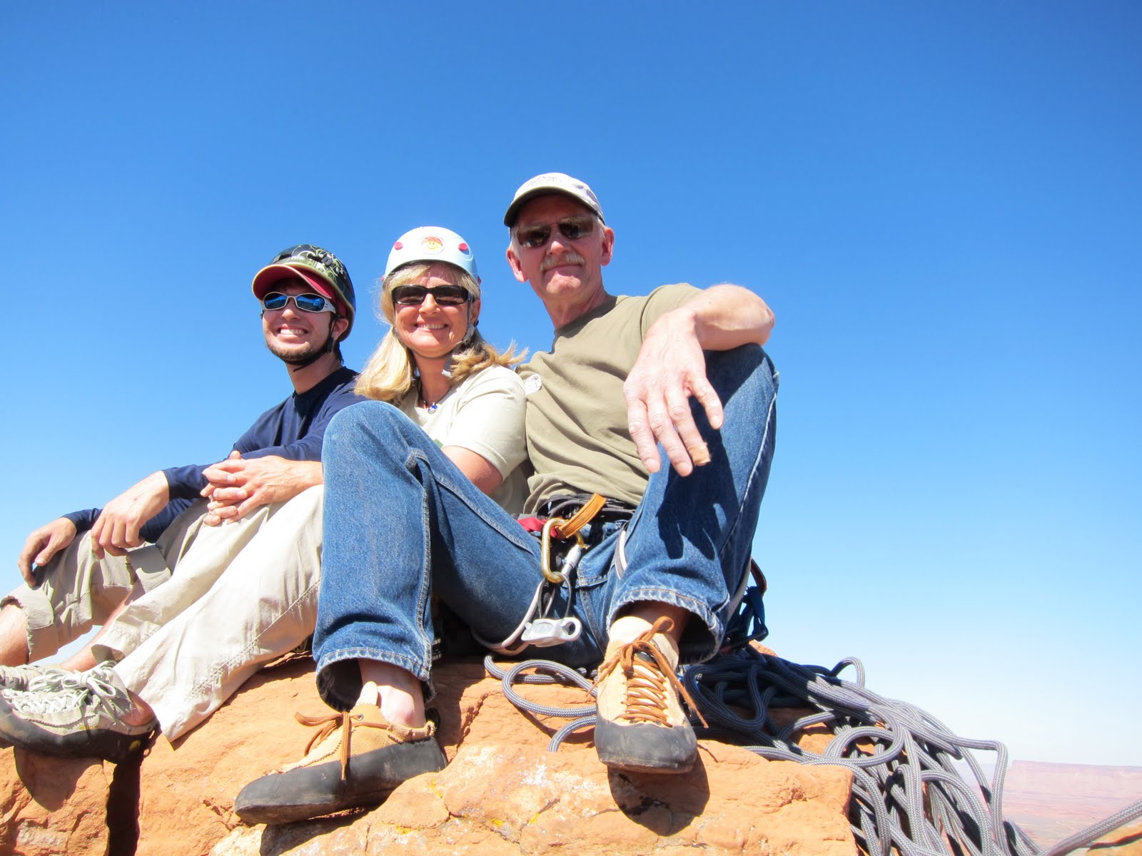
Noel, Chris, and I on the summit

Desert towers are fantastic places. The panoramas from the summit range from huge snow-capped mountains like the Abajos, the La Sals, and the Henry's, all visible from the Six Shooters. The La Sal mountains sit above Moab, Utah, and are my landmark from a hundred miles away as I drive I-70 south to Indian Creek each year. Twelve of the peaks in the range are over 12,000 feet high; Mount Peale, the highest peak rises to 12,721 feet. They, like the four other ranges in the viewshed are composed of igneous intrusions of porphyry.
The view from the Top: The La Sal Mountains

The Henry Mountains are the last mountain range in the U.S. to be mapped. John Wesley Powell mapped and named them during his field work floating the Colorado river in 1872, doing so in honour of Joseph Henry, the first secretary of the Smithsonian Institution. The Henry Mountains are composed of igneous rocks, a 25 million year old intrusion into the Colorado Plateau. They are the home of about 500 bison; the herd is one of only four free-roaming and genetically-pure herds in North America.
View to the west: the Needles District of Canyonlands National Park
The Henry Mountains in the distance

The rappel from the top is spectacular! A vertical to overhanging wall about 100' high rises directly from the base. I enjoyed photographing Chris and Noel as they roped down the rock.
Chris rappels down the cliff

In the evening, we walked over to the big campfire at the end of the campground. All the Silverbacks were holding court in their camp chairs. The stories grew, the legends increased, the we were part of it all.

Saturday, November 19, 2011

MARTHE, MY NEW FRENCH FRIEND

George and Marthe in the campground

"Ralph, I met this French woman, Marthe, in Yosemite this week; I told her I'd teach her to climb cracks in Indian Creek. She's suppose to be there this weekend, and she'll be looking for you by your white Ford truck at Creek Pasture campground." Jim is my main climbing partner: past president of the American Alpine Club, all-around great guy, calling on the cell phone from Yosemite.

The next morning Marthe walked by my truck, stopped and spoke with a beautiful French accent in perfect English, "Are you Ralph?" Thus began a most excellent week.

My campsite was perched on a slight rise with a short red sandstone cliff behind it to the west. A large folding table, 2-burner camp stove, cooler, grub box, and another full of dishes, pots, pans, and utensils surrounded the cooking area. I slept on a mattress in the back of the truck. Marthe eyed the setup, and I invited her to dinner: salmon steaks with broccoli and a salad. Many folks equate camping with suffering; I do not. Eating well in the out-of-doors is a reason to camp!

Jim drove over the next morning, and Marthe and I met him at the Donnelly Canyon parking area. The cliffs on both sides of the canyon are the most famous and usually fill with climbers by late morning. We are early risers, so we were first onto the cliffs. Our first venue was "Generic Crack", named because it is a pure 'splitter', a split straight up a flat face. Jim led up the one hundred foot climb, clipped the rope into two fixed anchors and lowered down. Now Marthe's turn.
"Generic Crack", an Indian Creek classic

Crack climbing is the most difficult type of climbing to learn and to do well. It takes a special technique that does not feel natural, unlike climbing on handholds and footholds. Depending on the size of the crack, a hand or fingers are inserted into the crack, cupped or squeezed to form a wedge, then the arm or fingers twisted downward to cam the hand into the crack. This hurts! To minimize the pain and the blood, the hands are wrapped with adhesive tape to make a glove on the back where all the pressure is exerted. After the taping session, Marthe headed up.
Marthe's first crack climb on "Organic Crack"

Grunts, complaints, excuses, swearing... Crack climbing is brutal, and Marthe was getting a lesson akin to being thrown into the deep end of the pool. She kept at it and little by little her technique improved as she moved up the crack. I was impressed.
Moving up

By now the sun was cooking us and the rock, so we hiked down the hill and up to the west-facing wall of Super Crack Buttress, home to the most elegant climbs. 'Double Cracks' was next on the tic list. It has a variety of holds and hand sizes, so it's a great place to learn the secrets. The feet are the most important; certainly learning to cam your hands into the crack is the more interesting, but the feet push you upwards. To make the feet work, you need to slide the toe in sideways with the knee out, then twist the knee in strait thus caming the foot into the crack in a tight wedge. It hurts. This is the downfall of most climbers who give up and don't end up liking to climb cracks.

On the "Double Cracks"

Double Cracks seemed made for her; she moved right up and completed the climb in short order. The named climbs have been done often, and two expansion bolts have been permanently set at the top of the climb. The leader puts the rope through the bolts, then the following climbers have a rope securing them from the top. When the climb is finished, the last person can pull one end of the rope through and coil it for the next climb.
Success!!

A belayer is the second person who holds the end of the rope secure to catch a fall of the person who is climbing. Marthe had been climbing quite a bit in her native France and was adept at face climbing and certainly rope handling methods like belaying the leader. Here she is belaying Jim as he set the rope up in the double cracks.

Belaying Jim

Jim was eager to show Marthe "The Incredible Hand Crack", or just Incredible as it's known here. It's one of the great classics of Indian Creek, a crack in a dihedral wall that overhangs about 10 feet half-way up the 100' pitch of climbing. Here Jim is leading the overhanging portion. He puts his hands way into the crack, makes a fist to jam the hands into a cam that will hold his body weight, then inserts and twists his feet and pushes up.
Jim leading "Incredible Hand Crack"

Marthe now had the technique and made short work of the first 30'. You can see her hands jammed into the crack, her left leg twisted a bit to the left, and the right toes cammed tight in the crack.
Marthe on "Incredible"

The overhang is difficult, both mentally and physically. Marthe tried to lay back, push her feet against the sandstone and pull out on the edge of the crack with her hands. This is possible for a short ways, but at Indian Creek with the huge climbs, you tire within 10 feet and fall off. It wasn't until she trusted her feet in the crack that she was able to master the moves, with Jim shouting encouragement and technique tips.
On the big overhang

We met a whole group of French climbers at the cliff. They live in a more concentrated society than we in the western US do, so there was a lot of grumbled criticism when they stole one of Jim's climbs. But the women were so beautiful it was hard to remain angry very long. By evening I had met two other climbers, Dougal from Wales, and Stephanie, an alpine guide from Chamonix, France. I invited them to dinner, excited that now Marthe would have a fellow country-woman to talk to. Stephanie is an outstanding climber; sometimes it's easier for women to teach other women climbing. I've picked up some of the terminology, like 'Push the bush' to make a woman pull her hips forward and get her correct balance. Women seem to be comfortable shouting that up to their friends. I'm more squeamish.
Stephanie, Dougal, Marthe, George at 'Creek Pasture' campground

The next day our friend George from Ridgway, Colorado, joined us. So, Jim, George, Marthe, and I spent the next few days climbing a variety of climbs all over Indian Creek. Jim had befriended folks from the Philippines, so he divided his time as best he could. Marthe had been on an extended trip climbing throughout the United States, but in two days she had to be in Las Vegas to fly out. So, one more day. Bummer! She wanted to visit the Grand Canyon on the way, so she left by noon after one more session. We bid her a sad farewell and wished her luck on her trip.
Dougal, Marthe around the campfire

Next morning we were off to the Scarface buttress, home to a variety of climbs...some very hard. I was impressed at Dougal and Stephanie attempting very difficult climbs and ticking them off one by one. I was at ease. The sun was warm, the company was the best, and the scenery was stunning. Couldn't ask for more.

The gang at the base of the Scarface cliff

George puts tape on his hands; Stephanie, Dougal

George hanging by his feet about 100' up "Big Guy"

Looking up at George