Monday, July 25, 2011

Canadian Rockies Part 4 - Eiffel Lake

Rebecca and I ticked off the best of the best hikes. Next on the list was Isis Lake, at the other side of Temple Mountain. As we drove up Highway 1 from Canmore, the sky turned horribly dark and the rain began to fall. We slowed down at a pit stop to mull over our options. Every day was precious, and this was one of the best hikes...maybe number 5 on our list. Back in Canmore the skies were blue. Here several hundred meters higher, we were in the thick of the weather. We owned fine parkas, had umbrellas and Alaska spirits so we continued on.

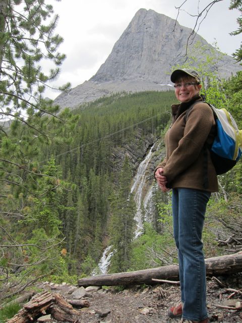
We drove up through the rain, past Lake Louise, turned onto the Morraine Lake road and headed uphill. A vintage green Mercedes coup drove up the 14 kilometers to Morraine lake ahead of us. I remarked at what a beautiful old car it was and how much I'd enjoy owning one. , By the time we arrived, the weather turned beautiful. The Canadian parks trail system is first class. Here is the sign for our trail up into the mountains above Morraine Lake to Eiffel Lake.

At the lake shore, crowds of tourist were disgorged from dieseling busses, that continued to belch fumes into the valley as the crowds wandered quickly to the lake edge, take a photo and hop back onto the bus. Behind the lake, the many peaks wound in a circle around the lake and up back around to Lake Louise to the west. Sentinel Pass rose to the right; a beautiful lodge was built on the lake and provided food and lodging for the guests.

There, sitting by the lake shore was the owner of the vintage Mercedes, a vintage Danish/Canadian. A fine gentleman who enjoyed our company and our appreciation for he treasure of a vehicle. We spoke for a while; I could have spent the rest of the day with him.
The trail gets right with the program. Seven cruel switchbacks brought finer and finer views as we ascended. We passed a lovely young family from Chicago. They were of Indian origin, but as American as we were. The girls, ages 10-13 were a delight and told us of their 15 mile hike the previous day.
At the trail junction we veered left; last time we'd gone straight up to Sentinel Pass. This time we were headed to Eiffel Lake, supposedly one of the most beautiful places in the Rockies. Soon we were on snow. The spring in the Rockies was late again this year. We should have learned from our adventures two years ago to bring boots instead of running shoes. Looking SE across the valley, every peak looked massive and forbidding.

We could see Morraine Lake far below; snow covered the peaks ahead and across from us.
The earliest spring plants were just beginning to flower.
Every step brought huge new peaks and cliffs into view.
We heard an avalanche across the valley, and I looked across just in time to snap a photo of the powder falling down the limestone cliffs.
The huge pines of the lower valley gave way to a larch forest, then to alpine tundra.
Looking ahead at Isis Lake, we could see that it was still frozen over. Huge snowfields barred the way, but undeterred we plowed on...in our running shoes. It was a little harum scarum over some of the steeper slopes, but we went methodically across.
The air cooled and we donned parkas; the sky threatened; the sun disappeared. We traded sweat for frost.
At the lake, the heavens opened. We sat under our umbrellas and ate the sandwich, apples, and granola bars. After a few minutes, the fun ended, and we packed up the remains and started the downward trek in the rain.
Not too far down the trail, I saw a hoary marmot...then three little one playing and fighting over some root and food in the ground. They looked and played like all kids! We must have spent fifteen minutes right next to them, taking photos and watching their antics. Momma seemed to be disinterested, but stayed within 10 feet or so.
My gazillion dollar Mammut parka was perfect. I stayed warm, dry and happy all day, taking photos, gabbing, boring Rebecca to tears with stories, and saving a bucket of memories for the next trip. Time for a beer!

Canadian Rockies Part 3 - Lake Annette

Mount Temple is the highpoint in the range, 11,624'. The hike into Lake Annette at the base of the North Face of the peak is one of the most beautiful in the Rocky Mountains. Lake Louise is next door; Moraine Lake on the south side; and fine hiking trails over Sentinal Pass connect them. We had done Sentinal Pass the previous trip, so today we could knit the whole mountain together. The only negative for the day was that a forest fire in northern Alberta filled the Bow valley with smoke. This first photo of the north face is hazy and gray--just like it looked to us; there is nothing wrong with my camera.
On the side of the trail, the flowers were flourishing in the late wet spring. Pink, soft as a down feather, these blossoms caught my eye as we entered the meadow near the creek.


We hiked along a fairly level trail; when it started to rise gently I never noticed, however Rebecca did. After a while it dipped down for a mile, but I thought it was level the whole way.

Mount Temple rose up out of the forest in front of us. North faces have intrigued me since I was young: the Eiger Norwand, North Face of the Dru, North Face of the Grand Jorasses, North Face of the Grand Teton. Here in front of me is the massive North Face of Mount Temple. I looked for climbing routes, lines of access, but the whole face looked forbidding.
The bridges over the river were beautifully made. We stopped for a bite between peaks; both of us took out our cameras an dueled to snap photos of the other. Her I caught Rebecca with a smile!
After the third bridge, we started up the last mile of trail, a steeper rise through a moist forest and a switchback trail to Lake Annette. The last few yards wound through steep snow, then there it was. It was an explosive view, even with the smoke. A couple of Goldeneyes swam and dived in the lake. I took a dozen photos, trying to get the upper mountain in focus, but he best shots were of Rebecca.
Her shoes were pinching her toes. Wish I could have bought another pair right there for her, but we wrapped a bit of tape around one toe, and she was much relieved. New shoes were in her future.
We took a joint photo in front of the face, bid good bye to Mount Temple and headed back to the car. It was such a beautiful day that I hardly realized the time that passed.
Suddenly in front of us, a porcupine waddled across the trail. It was more scared of us, but splayed out the quills on its tail as we passed. Five minutes later, another crossed the trail. I followed it up into the thick of the forest where it crawled under a rotten log, so I turned on the flash and got a photo of the little guy.
Not ten minutes later, a third porcupine crossed the trail, flared its tail, then headed up a tree. It was the night of the porcupines!


I thought the route down would have been a constant grade to the car. I had forgotten the mile uphill grade; Rebecca remembered. Every rise I thought was the last one. How wrong I was. We talked and had a fine walk back to the car after one of the most beautiful hikes into the Rocky Mountains. Time for a beer!

Sunday, July 24, 2011

Canadian Rockies Part 2 - Grassi Lakes

Grassi Lakes, named after an early citizen in the area, are nestled in the narrow valley just above the town of Canmore. The trail up to the lakes starts from the south edge of town next to the Nordic Center, so hundreds of people every day hike the two or so miles up to the lakes. After a steep 8 miles on Friday, we opted for a shorter walk on Saturday, so although we expected crowds, we were happy for the close but beautiful trail. We passed and were passed by a lot of folks: families, hikers, Olympic athletes, tourists from Japan, locals on a Sunday walk. The first lake was stunning. It looked like one of the Yellowstone hot springs; its stunning colors were so inviting, but I didn't see anyone swimming, no garbage, no disturbance.


Moving up from the lakes we could see the peaks above us to the east and west, giant limestone crags. It would be great to climb there someday.

The water in the tiny creek looked great for drinking, but we had brought our own. It comes out of a large reservoir above, and to the SW, huge shining steel penstocks drop down the cliff face right into town. Electrical lines follow. Although this is virtual wilderness, it exists butting up against a large town with all the modern conveniences.

The lakes were stunning. I took too many photographs, but likely not nearly as many as the Japanese tourists, armed with the latest assortment of fine camera equipment, constantly snapping photos of everything.


Rock climbers have their way on the limestone cliffs on both sides of the canyon. I was intrigued and watched for a long time. Rebecca asked if I wanted to climb and why I didn't bring my shoes and chalk bag. This was a hiking trip, and I had climbed these cliffs a few years earlier with Jim Donini and Charlotte Fox when the American Alpine Club held it's annual meeting in Banff in conjunction with the Canadian Alpine Club.

We walked on up to the top where a powerful wind was blowing the dust and dirt horizontally into our eyes. Nothing to see there, just a dam, parking lot, and tough going, so we turned around and headed down.


There was an 'Easy Trail' and a 'Hard Trail'. We had come up the 'Easy Trail', so we opted to descend the 'Hard Trail', which was not hard, just hundreds of steps down a cliff side. It was worth the steps, because the views were excellent: huge waterfalls, steep mountains, vertical cliffs below our feet, and more tourists.

It was soon over; a shorter day, but this gave us time to go shopping in Canmore. Two years ago I'd spent a zillion dollars on a Mammut parka. Today I spent half a zillion on a Mammut hoody from the same store. Time for a beer!

Saturday, July 23, 2011

Canadian Rockies Part 1 - Borgeau Lake

Rebecca set aside a week in June for her timeshare condo in Canmore, Alberta, the gateway to Banff National Park. We planned to do a number of the classic hikes in the park, as many as the snowline and time would allow.

On Thursday we flew all night on the Red-Eye from Anchorage to Seattle, boarded a smaller plane to Calgary, rented a cool car, and headed to the supermarket to stock up for a week in the mountains. The weather was hot, the sky was flawless, and we thought we had struck alpine gold. However, we had read the weather report and knew that clouds and rain were in our future.

For our first hike we picked Eiffel Lake and Wenkchemna Pass, a rather long and steep hike, but a classic for the opportunity to get to the top of a peak and view much of the park in every direction.


The Banff-Jasper highway, Canada Route 1, is lined on both sides by high wire fences to keep the wildlife from entering the roadway. At convenient intervals, large rock and earth bridges have been constructed over the highway so the animals can cross to the river or mountains. They are architecturally beautiful, planted with spruce, pines and birch to look like natural crossings to the critters. To enter the trailhead we needed to climb a metal style and open a gate...easy for us, impossible for a bear.

Many of the trees seem to suffer from a bark beetle infestation, so we found dead trees in large groves. The forest was still stunning, and the trails were easy to walk, well maintained, and of a very comfortable grade.


Rebecca and I stopped often to photograph the flowers. In this area, beautiful lady slipper orchids were everywhere.


The floor of the forest was covered with moss, soft under foot, and fragile. The trail started out fairly even and straight, but after a while switchbacks appeared as we gained altitude. Looking out to the west, a steep cliff rose from the river below. The sounds of the highway disappeared and were overtaken by the rushing water.


Looking back across the valley we could see the vertical limestone cliffs and pinnacles, so different from the glaciers and craggy peaks above us. It was like two different worlds on either side of the Bow river.

Our first snow was the remains of an avalanche, covered with rock and debris from above.

We looked up to see our goal on the other side of the valley. We still had a way to go, having covered about 4 miles so far.

A nice bridge covered a small steep stream coming from a large snowfield above. The Canadian park trails were so civilized after 31 years in Alaska. We sat down under a tree for lunch, and the afternoon rains began. Four hikers came down the trail and reported that it was solid snow, unconsolidated and nearly waist deep ahead by Eiffel Lake. We were dressed in running shoes and by now had an 8-mile round trip for our first outing.

Back to the condo and a Cesar chicken salad washed down with a beer, energized for day two!

Tuesday, May 17, 2011

Sand Canyon


Daph at the Canyon entrance

Sand Canyon, or as the BLM sign says, "Canyon of the Ancients", a path to spectacular Anasazi ruins in the very southwest corner of Colorado, about 20 miles west of Cortez. Daphne lives in Mancos, just up the road, but she's leaving for Philadelphia soon, so I flew down from Alaska to visit. I've always had a great time with her, so we decided to take a day-hike up a local canyon with her two hounds, Diddy and Archie. Sir Didymus, "Diddy", is a Pomeranian named for the dog in the David Bowie movie, "Labyrinth".

Looking through a hole in Castle Rock back down to the road

Right in front of the parking lot is Castle Rock. I hiked up to the backside and saw the site of a storage bin, a rock structure down the trail, and the great view of the area. All within sight of the road.


A yucca in bloom

The weather in Colorado has been cool and wet, so the grass along the river bottoms is green and the flowers are out in profusion. Cacti are all in bloom, too.


Daphne with Archie in the pack

Archie is a long-haired Chihuahua that Daph rescued from a puppy mill several years ago. In spite of their size, they are tough little guys. Archie was feeling poorly, the heat was turned up high, and we had a ways to go, so Daph made a nest in her pack and carried him in.


The Entrada sandstone showing a slight defect
The trail winds up over slickrock on the west side of the canyon. To our left short cliffs of creamy pink Entrada sandstone barred the way. The BLM has marked short "Spur" trails that lead to the Anasazi ruins that dot the way.


Scarlet Gilia

I couldn't help photographing every flower: the colors were stunning, like the Scarlet Gilia, small cacti, and bushes. If I didn't think it would overload the site, I'd have published dozens.


Diddy on the precipice

About two miles out the trail overlooks Sand Canyon, 250 feet below. Diddy was fascinated, but Daphne called him back from the lip. I was fascinated, too!


The onion shaped Anasazi house

All the ruins were spectacular, little homes and granaries set in alcoves in the cliffs. One looked like an oven, or an onion. I is my favorite setting.


Looking back at Sleeping Ute Mountain

We settled in for lunch and looked south to Ute Mountain, a high pinion and juniper covered peak. On a cooler day I'd like to hike to the top and get a view of the whole countryside. To the east is the long Mesa Verde, home to the National Park Service park where some of the most profound, intact, and complex cliff dwellings are located. Our canyon today was special, too. At one point we saw the outline of a kiva, a circular structure that is generally thought to be for ceremonial purposes. The modern Hopi and Zuni are the descendants of the ancients who built these structures between 2000 and 700 years ago, so the modern kivas give archeologists a clue to their use.


Daphne in the house

I photographed Daphne in one of the little structures to give a sense of scale here. The masonry, composed of sandstone blocks and red mud, often mixed with organic material, is still strong and intact, because the dwellings are sheltered under cliffs and haven't suffered the damage rain and the elements would inflict. The upright slabs of storage bins poked up through the dirt.


Lunch with the Anasazi

The floor of this little room was built on the sloping sandstone ledge, then filled with sand up to the point of Daphne's shoe. Diddy hung in the cool shade of the corner out of the afternoon sun, which was likely a cooking 80 plus degrees.

Cactus flowers

These little barrel shaped cacti were in exotic full bloom and sucked us in until we were down on our knees with the camera inches away.


A spectacular example of Anasazi architecture

Many of the cliff dwellings are multi-storied, or on several levels in one sheltered alcove, as above. Small steps, "Moki Steps", are carved into the rock to facilitate passage to the higher levels, or wooden ladders, still in place and strong after at least 700 years are used.


Diddy on the trail

The day wore on, we leisurely inspected every small path and ruin, but by late afternoon we turned around and headed back to the car. Time flew by as we checked out more flowers, more stones, and admired the scenery. The dogs seemed not to notice the distance. Archie, much improved, and likely a little barn sour, headed home like a cockroach, right on my heels.


End of the day!